PIs: Luc Neppel, Pierre Marchand
Appreciating the urban hydrologic hazard requires the monitoring of rainfall and surface flow variables with a typical resolution of 102 m. This resolution is significantly higher than that of standard meteorological products, such as radar-monitored rainfall fields (radar rainfall fields are usually provided with a 1 km x 1 km resolution).
A first reserach path consists in developing downscaling methods that will provide 100 m resolution rainfall fields from the 1 km resolution classical mterological products. The HSM urban observatory is currently deploying a high density network of automatic rainfall gaucges over the Verdanson area. The purpose is (i) to characterize the spatial and temporal variability of the rainfall field a small space and time scales, (ii) to develop downscaling methods that will allow the 1 km x 1 km rainfall fields to be downscaled with a 100 m x 100 m resolution.
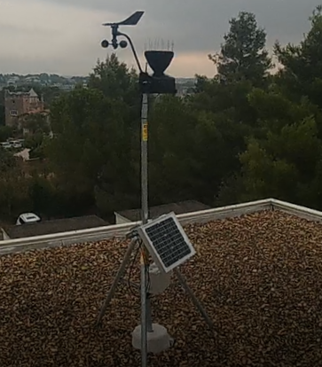
(c) P. Marchand
10 gauges are currently implemented.
Fast and robust models for flood crisis management are under development. Examples are the ATHyS and porosity-based SW2D codes, as well as parameter regionlization-based models.
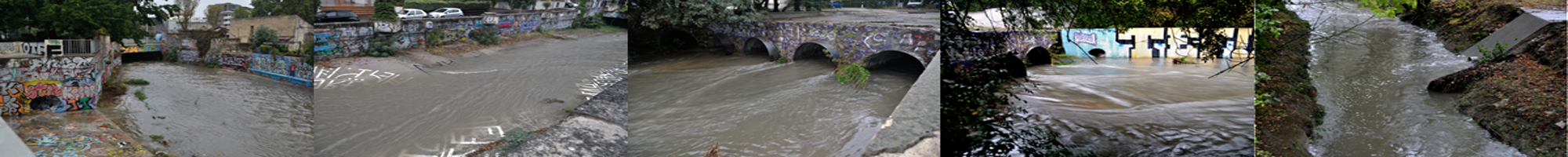
Hydrological events observations